ნორვეგიის ეროვნული პარკების სია
ნორვეგიაში 47 ეროვნული პარკი მდებარეობს, რომელთაგან 40 კონტინენტურ ნაწილში, ხოლო 7 სვალბარდზეა განლაგებული. ეროვნული პარკები განსაკუთრებული და მკაცრი ყურადღების ქვეშაა და თითქმის ყველა სახის მოტორიზებული ტრანსპორტი აკრძალულია. პარკების ტერიტორიაზე დაშვებულია ფეხით მოგზაურობა, თხილამურებით სრიალი და კემპინგი, თუმცა მნახველებს ბუნებაზე მოფრთხილება ევალებათ. გზები, თავშესაფრები და ეროვნული პარკის ცენტრები პარკების გარეთაა მოწყობილი. პარკები ნორვეგიის გარემოს დაცვის სააგენტოა და ადგილობრივი საგრაფოს გუბერნატორის დაქვემბდებარების ქვეშაა.[1]
იტრე-ვალერის ეროვნული პარკი საზღვაო პარკია. სვალბარდის სხვა პარკებიც მოიცავს საზღვაო ტერიტორიებს. უდიდესი პარკი სერ-შპიცბერგენის ეროვნული პარკია, რომლიც ფართობიც 13 286 კმ²-ია, თუმცა ხმელეთს მხოლოდ 5 141 კმ² უკავია.[2] უახლესი ეროვნული პარკი ლოფოტოდენის ეროვნული პარკია, რომელიც 2018 წელს დაარსდა. უდიდესი ეროვნული პარკი ნორვეგიის კონტინენტურ ნაწილში ჰარდანგერვიდის ეროვნული პარკია, რომლის ფართობიც 3 422 კმ²-ს შეადგენს. ყველაზე პატარა ეროვნული პარკი გუტულიის ეროვნული პარკია, რომლის ფართობიც 23 კმ²-ია.[1]
ამჟამინდელი პარკების სია[რედაქტირება | წყაროს რედაქტირება]
| სურათი | სახელწოდება | საგრაფო(ები) | დაარსდა | ფართობი | აღწერა | სქოლიო |
|---|---|---|---|---|---|---|
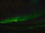
|
ონდერდალენი | ტრომსი | 1970 | 134 kм² (1.44×10⁹ sq ft) | [1] | |

|
ბლოფიელა-შაკერფიელი | ნურ-ტრენდელაგი | 2004 | 1,924 kм² (2.071×10¹⁰ sq ft) | [1] | |
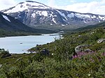
|
ბრეჰეიმენი | ინლანდეტი და ვესლანი | 2009 | 1,671 kм² (1.799×10¹⁰ sq ft) | ||

|
ბერგენფიელი | ტრენდელაგი, ნურლანი | 1963 | 1,447 kм² (1.558×10¹⁰ sq ft) | [1] | |
| დოვრე | ინლანდეტი | 2003 | 289 kм² (3.11×10⁹ sq ft) | [1] | ||

|
სოვრეფიელ-სუნდალსფიელა | ინლანდეტი, ტრენდელაგი და მერე-ოგ-რუმსდალი | 1974 | 1,693 kм² (1.822×10¹⁰ sq ft) | [1] | |

|
Færder | Vestfold | 2013 | 350 kм² (3.8×10⁹ sq ft) | [1] | |

|
ფემუნსმარკა | ინლანდეტი, ტრენდელაგი | 1971 | 573 kм² (6.17×10⁹ sq ft) | [1] | |
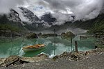
|
ფოლგეფონა | ვესტლანი | 2005 | 545 kм² (5.87×10⁹ sq ft) | [1] | |

|
ფორლანეტი | სვალბარდი | 1973 | 4,647 kм² (5.002×10¹⁰ sq ft) | The park covers the uninhabited island of Prins Karls Forland and the surrounding waters. Forlandet is long and narrow with tall peaks, separated in two by the low Forlandsletta. It is the northernmost habitat of harbor seal and a nesting place for common guillemot. Wetland birds nest at Plankeholmane and Forlandsøyane, and the west coast is an overwintering site for seabirds. | [2] |

|
Forollhogna | Sør-Trøndelag, Hedmark | 2001 | 1,062 kм² (1.143×10¹⁰ sq ft) | [1] | |
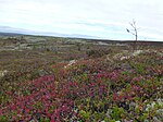
|
Fulufjellet | Hedmark | 2012 | 83 kм² (890,000,000 sq ft) | [3] | |

|
Gutulia | Hedmark | 1968 | 23 kм² (250,000,000 sq ft) | [1] | |
|
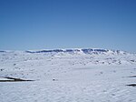
Hallingskarvet | Buskerud, Hordaland | 2006 | 450 kм² (4.8×10⁹ sq ft) | ||

|
Hardangervidda | Buskerud, Hordaland, Telemark | 1981 | 3,422 kм² (3.683×10¹⁰ sq ft) | [1] | |

|
Indre Wijdefjorden | სვალბარდი | 2005 | 1,127 kм² (1.213×10¹⁰ sq ft) | Located in a steep fjord landscape in northern Spitsbergen, the park covers the inner part of Wijdefjorden—the longest fjord on Svalbard. On both sides of Wijdefjorden there is High Arctic steppe vegetation, dominated by grasses and extremely dry, basic earth. Along with vegetation found on nesting cliffs, it is the most exclusive flora in Svalbard. Of the larger fjords on Svalbard, Wijdefjorden is the least affected by humans. | [2] |
|
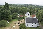
Jomfruland | Telemark | 2016 | 117 kм² (1.26×10⁹ sq ft) | ||

|
Jostedalsbreen | Sogn og Fjordane | 1991 | 1,310 kм² (1.41×10¹⁰ sq ft) | [1] | |
|
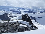
Jotunheimen | Oppland, Sogn og Fjordane | 1980 | 1,151 kм² (1.239×10¹⁰ sq ft) | [1] | |

|
Junkerdal | Nordland | 2004 | 682 kм² (7.34×10⁹ sq ft) | [1] | |
|
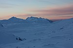
Làhku | Nordland | 2012 | 188 kм² (2.02×10⁹ sq ft) | ||

|
Langsua | Oppland | 2011 | 537 kм² (5.78×10⁹ sq ft) | ||
| — | Lierne | Nordland | 2004 | 333 kм² (3.58×10⁹ sq ft) | [1] | |

|
Lofotodden | Nordland | 2018 | 99 kм² (1.07×10⁹ sq ft) | ||

|
Lomsdal–Visten | Nordland | 2009 | 682 kм² (7.34×10⁹ sq ft) | ||

|
Møysalen | Nordland | 2003 | 51 kм² (550,000,000 sq ft) | ||
|
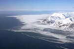
Nordre Isfjorden | სვალბარდი | 2003 | 2,954 kм² (3.180×10¹⁰ sq ft) | Protecting the northern shore of Isfjorden on Spitsbergen, the park consists of a long shoreline with lush vegetation serving as breeding grounds for birds. The landscape varies from the barren and lunar-like to sandy plains and several meter-thick layers of deposits. | [2] |

|
Nordvest-Spitsbergen | სვალბარდი | 1973 | 9,914 kм² (1.0671×10¹¹ sq ft) | The northwestern part of Spitsbergen has the archipelago's most varied nature and features some of the most important cultural heritage sites from whaling and Arctic exploration, such as Smeerenburg and Virgohamna. The park is habitat for Arctic fox, reindeer and Arctic char. Moffen Nature Reserve and three bird sanctuaries (Guissezholmen, Moseøya and Skorpa) are important breeding grounds for birds, especially eider and geese. The warm springs of Bockfjorden give a unique local flora. | [2] |
|
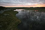
Øvre Anárjohka | Finnmark | 1975 | 1,390 kм² (1.50×10¹⁰ sq ft) | [1] | |
|
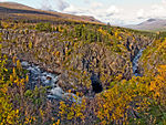
Øvre Dividal | Troms | 1971 | 750 kм² (8.1×10⁹ sq ft) | [1] | |

|
Øvre Pasvik | Finnmark | 1970 | 119 kм² (1.28×10⁹ sq ft) | Part of Pasvik–Inari Trilateral Park, the area is dominated by Siberian-like taiga consisting of old-growth Scots pine, shallow lakes and bog. The traditional Skolts area is still used for reindeer husbandry. The park located in Pasvikdalen and is a habitat for brown bear and moose. | [4] |

|
Raet | Aust-Agder | 2016 | 607 kм² (6.53×10⁹ sq ft) | ||

|
Rago | Nordland | 1971 | 171 kм² (1.84×10⁹ sq ft) | [1] | |

|
Reinheimen | Oppland, Møre og Romsdal | 2006 | 1,969 kм² (2.119×10¹⁰ sq ft) | ||

|
Reisa | Troms | 1986 | 803 kм² (8.64×10⁹ sq ft) | [1] | |

|
Rohkunborri | Troms | 2011 | 571 kм² (6.15×10⁹ sq ft) | ||

|
Rondane | Hedmark, Oppland | 1962 | 963 kм² (1.037×10¹⁰ sq ft) | [1] | |
|
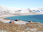
Saltfjellet–Svartisen | Nordland | 1989 | 2,192 kм² (2.359×10¹⁰ sq ft) | [1] | |

|
Sassen–Bünsow Land | სვალბარდი | 2003 | 1,230 kм² (1.32×10¹⁰ sq ft) | The park covers Tempelfjorden, Bünsow Land and the vast fluvial plain of Sassendalen, located at the head of Isfjorden. Tempelfjorden is an important breeding ground for ringed seals, while Sassendalen and Gipsdalen are important breeding grounds for geese. Bünsow Land has the only European occurrence of polar mouse-ear (Cerastium regelii) and broad-sepal saxifrage (Saxifraga platysepala). | [2] |

|
Seiland | Finnmark | 2006 | 316 kм² (3.40×10⁹ sq ft) | ||
|
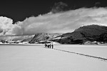
Sjunkhatten | Nordland | 2010 | 417 kм² (4.49×10⁹ sq ft) | ||

|
Skarvan and Roltdalen | Nord-Trøndelag, Sør-Trøndelag | 2004 | 441 kм² (4.75×10⁹ sq ft) | [1] | |

|
Sør-Spitsbergen | სვალბარდი | 1973 | 13,286 kм² (1.4301×10¹¹ sq ft) | Covering the southern part of Spitsbergen (Wedel Jarlsberg Land, Torell Land and Sørkapp Land), the western part has jagged mountains while the eastern part is more rounded. Hornsund is an important migration area for polar bears, while four bird sanctuaries (Olsholmen, Isøyane, Dunøyane and Sørkapp) are vital nesting grounds for migratory seabirds. | [2] |
| Stabbursdalen | Finnmark | 1970 | 747 kм² (8.04×10⁹ sq ft) | [1] | ||

|
Van Mijenfjorden | სვალბარდი | 2021 | 4,251 kм² (4.576×10¹⁰ sq ft) | [2] | |

|
Varangerhalvøya | Finnmark | 2006 | 1,804 kм² (1.942×10¹⁰ sq ft) | ||
|
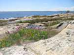
Ytre Hvaler | Østfold | 2009 | 354 kм² (3.81×10⁹ sq ft) |
ყოფილი პარკების სია[რედაქტირება | წყაროს რედაქტირება]
| სახელწოდება | საგრაფო | დაარსდა | გაუქმდა | ფართობი (ხმელეთი. კმ2) |
ფართობიa (ხმელეთი, კვ. მილი) |
შეიცვალა | სქოლიო |
|---|---|---|---|---|---|---|---|
| გრესემოენი | ნურ-ტრენდელაგი | 1970 | 2004 | 182 | 1.96×10⁹ | ბლოფიელა-სკიაეკერფიელი |
რესურსები ინტერნეტში[რედაქტირება | წყაროს რედაქტირება]

- Norwegian national parks
- Pictures of all mainland national parks დაარქივებული 2021-06-05 საიტზე Wayback Machine.
სქოლიო[რედაქტირება | წყაროს რედაქტირება]
- ↑ 1.00 1.01 1.02 1.03 1.04 1.05 1.06 1.07 1.08 1.09 1.10 1.11 1.12 1.13 1.14 1.15 1.16 1.17 1.18 1.19 1.20 1.21 1.22 1.23 1.24 Maps and information. Norwegian Directorate for Nature Management. დაარქივებულია ორიგინალიდან — 26 სექტემბერი 2011. ციტირების თარიღი: 21 August 2011
- ↑ 2.0 2.1 2.2 2.3 2.4 2.5 2.6 2.7 Protected Areas in Svalbard. Norwegian Directorate for Nature Management. დაარქივებულია ორიგინალიდან — 27 სექტემბერი 2011. ციტირების თარიღი: 14 May 2010
- ↑ Fulufjellet nasjonalpark er oppretta (Norwegian). Miljøverndepartementet. ციტირების თარიღი: 22 May 2012
- ↑ Øvre Pasvik nasjonalpark no. Norwegian Directorate for Nature Management. დაარქივებულია ორიგინალიდან — 29 მარტი 2012. ციტირების თარიღი: 24 August 2012
