
ფაილი:Georgian governorate 1823.jpg
თავდაპირველი ფაილი ((4 920 × 4 764 პიქსელი, ფაილის ზომა: 5,32 მბ, MIME ტიპი: image/jpeg))
| ეს ფაილი მდებარეობს Wikimedia Commons სერვერზე. იხილეთ მისი აღწერის გვერდი სრული ინფორმაციისთვის. |
 |
გადასვლა ფაილის გვერდზე |
რეზიუმე
| აღწერა |
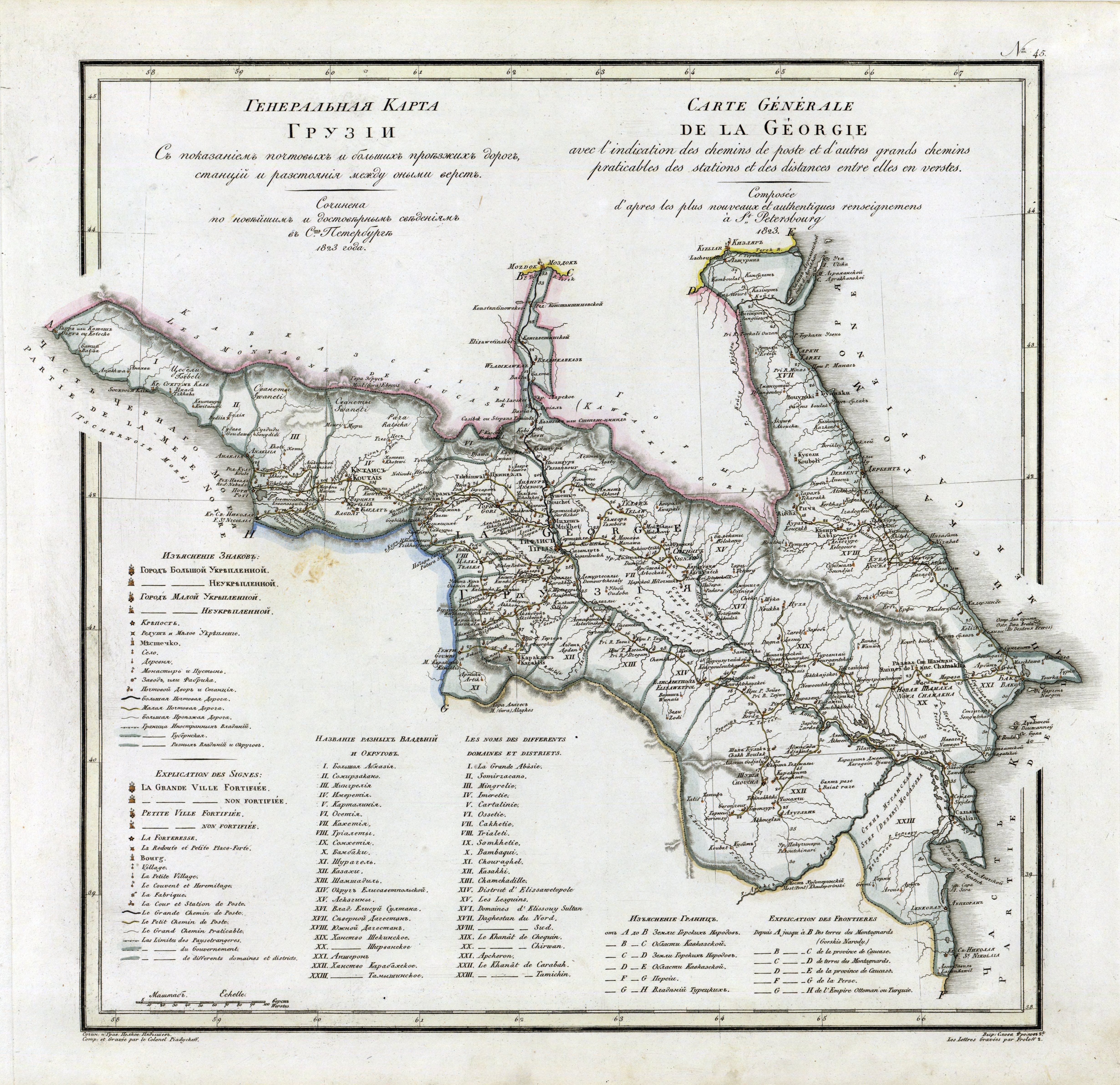
Русский: Грузия
English: Georgian governorate |
| თარიღი | |
| წყარო |
Русский: Географический атлас Российской империи, Царства Польского и Великого Княжества Финлянского, расположенный по губерниям на двух языках с означением в онных городах, местечек, сель, деревень и всех примичательнийших мест, почтовых и больших проезжих дорог, станций и расстояния между оными, и прочими селениями в верстах и милях на 70 листах с Генеральною картою и Таблицей расстояния верст по почтовым дорогам между знатнийшими городами.Сочинен по новейшим и достоверным сведениям, в пользу обучающихся Российской Географии и для составления дорожников путешественникам,служащих Военно-топографического дела, Его Императорского Величества по квартирмейстерской части подполковником Пядышевым <be>Russkiy: Geograficheskiy atlas Rossiyskoy imperii, Tsarstva Pol'skogo i Velikogo Knyazhestva Finlyanskogo, raspolozhennyy po guberniyam na dvukh yazykakh s oznacheniyem v onnykh gorodakh, mestechek, sel', dereven' i vsekh primichatel'niyshikh mest, pochtovykh i bol'shikh proyezzhikh dorog, stantsiy i rasstoyaniya mezhdu onymi, i prochimi seleniyami v verstakh i milyakh na 70 listakh s General'noyu kartoyu i Tablitsey rasstoyaniya verst po pochtovym dorogam mezhdu znatniyshimi gorodami.Sochinen po noveyshim i dostovernym svedeniyam, v pol'zu obuchayushchikhsya Rossiyskoy Geografii i dlya sostavleniya dorozhnikov puteshestvennikam,sluzhashchikh Voyenno-topograficheskogo dela, Yego Imperatorskogo Velichestva po kvartirmeysterskoy chasti podpolkovnikom PyadyshevymEnglish: Geographical atlas of the Russian Empire, the Kingdom of Poland and the Grand Duchy of Finland, located in the provinces in two languages with the designation in these cities, towns, villages, villages and all the most remarkable places, postal and major roads, stations and the distance between them, and others settlements in versts and miles on 70 sheets with a General Map and a Table of the distance of versts along postal roads between the most important cities. Composed according to the latest and reliable information, in favor of students of Russian Geography and for compiling road maps for travelers serving in the Military Topographic Affairs, His Imperial Majesty for quartermaster unit by Lieutenant Colonel Pyadyshev |
| ავტორი |
Русский: Пядышев Василий Петрович (1768-1835) |
| სხვა ვერსიები |
|

ლიცენზია
|
This work is in the public domain in its country of origin and other countries and areas where the copyright term is the author's life plus 70 years or fewer.
| |
| This file has been identified as being free of known restrictions under copyright law, including all related and neighboring rights. | |
ფაილის ისტორია
დააწკაპუნეთ თარიღზე/დროზე ფაილის დასათვალიერებლად, როგორც ის მაშინ გამოიყურებოდა.
| თარიღი/დრო | მინიატიურა | ზომები | მომხმარებელი | შენიშვნა | |
|---|---|---|---|---|---|
| მიმდინარე | 16:35, 20 იანვარი 2013 | | 4 920×4 764 (5,32 მბ) | Slick-o-bot | Bot: convert to a non-interlaced jpeg image (see bug #17645) |
| 20:53, 7 სექტემბერი 2010 |  | 4 920×4 764 (4,95 მბ) | ShinePhantom |
ბმულები
ამ ფაილზე ბმული მოცემულია შემდეგ გვერდებზე:
ფაილის გლობალური გამოყენება
ეს ფაილი გამოიყენება შემდეგ ვიკებში:
- გამოყენება az.wikipedia.org-ში
- გამოყენება bg.wikipedia.org-ში
- გამოყენება en.wikipedia.org-ში
- გამოყენება es.wikipedia.org-ში
- გამოყენება ja.wikipedia.org-ში
- გამოყენება ko.wikipedia.org-ში
- გამოყენება ro.wikipedia.org-ში
- გამოყენება ru.wikipedia.org-ში
- გამოყენება sr.wikipedia.org-ში
- გამოყენება tr.wikipedia.org-ში
- გამოყენება uk.wikipedia.org-ში
- გამოყენება www.wikidata.org-ში
- გამოყენება zh.wikipedia.org-ში