
ფაილი:Kaali crater.jpg

თავდაპირველი ფაილი ((4 000 × 3 000 პიქსელი, ფაილის ზომა: 4,03 მბ, MIME ტიპი: image/jpeg))
| ეს ფაილი მდებარეობს Wikimedia Commons სერვერზე. იხილეთ მისი აღწერის გვერდი სრული ინფორმაციისთვის. |
 |
გადასვლა ფაილის გვერდზე |
| აღწერა |
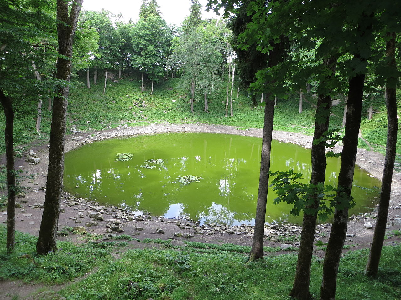
A green pool of water at the largest of the meteorite craters at Kaali on Saaremaa island in Estonia. The nine <a href="http://en.wikipedia.org/wiki/Kaali_crater" rel="nofollow">Kaali craters</a> were formed between 4,000 and 7,500 years ago by meteorite fragments from an iron meteor that broke up into multiple fragments 5-10 km above ground. The original meteor may have been up to 10,000 metric tonnes when it entered the atmosphere at a speed of 15-45 km/sec, but the fragment creating the main crater was only 20-80 tonne when it hit the ground at 10-20 km/sec. This was the last giant meteorite fall in a densely populated area, and it left traces in old European folklore (Edda and Kalevala) as well as in written sources (Pytheas and Scandinavian Sagas). [<a href="http://beer-trotter.blogspot.no/2013/11/a-couple-of-days-on-saaremaa.html" rel="nofollow">read more</a>] |
||
| თარიღი | |||
| წყარო | Flickr: Kaali crater | ||
| ავტორი | Bernt Rostad | ||
| უფლება (ფაილის მეორეული გამოყენება) |
ეს ნამუშევარი ვრცელდება Creative Commons Attribution 2.0 Generic ლიცენზიით.
|
| კამერის მდებარეობა | | იხილეთ ეს და სხვა ახლომდებარე სურათები საიტ(ებ)ზე OpenStreetMap |
|---|
ფაილის ისტორია
დააწკაპუნეთ თარიღზე/დროზე ფაილის დასათვალიერებლად, როგორც ის მაშინ გამოიყურებოდა.
| თარიღი/დრო | მინიატიურა | ზომები | მომხმარებელი | შენიშვნა | |
|---|---|---|---|---|---|
| მიმდინარე | 17:52, 9 ნოემბერი 2013 | | 4 000×3 000 (4,03 მბ) | Flickr upload bot | Uploaded from http://flickr.com/photo/67975030@N00/10542805205 using Flickr upload bot |
ბმულები
ამ ფაილზე ბმული მოცემულია შემდეგ გვერდებზე:
ფაილის გლობალური გამოყენება
ეს ფაილი გამოიყენება შემდეგ ვიკებში:
- გამოყენება ceb.wikipedia.org-ში
- გამოყენება en.wikipedia.org-ში
- გამოყენება es.wikipedia.org-ში
- გამოყენება he.wikipedia.org-ში
- გამოყენება hy.wikipedia.org-ში
- გამოყენება it.wikipedia.org-ში
- გამოყენება ms.wikipedia.org-ში
- გამოყენება no.wikipedia.org-ში
- გამოყენება pl.wikipedia.org-ში
- გამოყენება ro.wikipedia.org-ში
- გამოყენება ru.wikipedia.org-ში
- გამოყენება sr.wikipedia.org-ში
- გამოყენება uk.wikipedia.org-ში
- გამოყენება www.wikidata.org-ში
- გამოყენება zh-min-nan.wikipedia.org-ში
- გამოყენება zh.wikipedia.org-ში