
ფაილი:Map indicating Davis Strait.png
უფრო მაღალი გარჩევადობა არ არის შესაძლებელი.
Map_indicating_Davis_Strait.png ((340 × 330 პიქსელი, ფაილის ზომა: 47 კბ, MIME ტიპი: image/png))
| ეს ფაილი მდებარეობს Wikimedia Commons სერვერზე. იხილეთ მისი აღწერის გვერდი სრული ინფორმაციისთვის. |
 |
გადასვლა ფაილის გვერდზე |
რეზიუმე
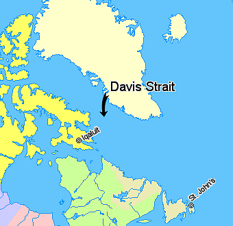
Map indicating Davis Strait, lying between Greenland and Nunavut, Canada.
Nunavut
Quebec
Newfoundland and Labrador
Regions outside Canada (Greenland, Iceland)
© Her Majesty the Queen in Right of Canada, Department of Natural Resources. All rights reserved.
Licence Agreement
ლიცენზია

|
The copyright holder of this work allows anyone to use it for any purpose including unrestricted redistribution, commercial use, and modification.
Usage notes:
|
ფაილის ისტორია
დააწკაპუნეთ თარიღზე/დროზე ფაილის დასათვალიერებლად, როგორც ის მაშინ გამოიყურებოდა.
| თარიღი/დრო | მინიატიურა | ზომები | მომხმარებელი | შენიშვნა | |
|---|---|---|---|---|---|
| მიმდინარე | 11:08, 21 მარტი 2006 | | 340×330 (47 კბ) | David Kernow~commonswiki | Map indicating Davis Strait, lying between Nunavut, Canada and Greenland. {{legend|#ffff66|Nunavut}} {{legend|#d5fe94|Quebec}} {{legend|#ecebb6|Newfoundland and Labrador}} {{legend|#ffffcc|Regions outside Canada (Greenland, Iceland)}} |
ბმულები
ეს ფაილი არცერთ გვერდზე არ გამოიყენება.
ფაილის გლობალური გამოყენება
ეს ფაილი გამოიყენება შემდეგ ვიკებში:
- გამოყენება be.wikipedia.org-ში
- გამოყენება bg.wikipedia.org-ში
- გამოყენება bn.wikipedia.org-ში
- გამოყენება bs.wikipedia.org-ში
- გამოყენება cs.wikipedia.org-ში
- გამოყენება da.wikipedia.org-ში
- გამოყენება de.wikipedia.org-ში
- გამოყენება el.wikipedia.org-ში
- გამოყენება en.wikipedia.org-ში
- გამოყენება eo.wikipedia.org-ში
- გამოყენება fi.wikipedia.org-ში
- გამოყენება fy.wikipedia.org-ში
- გამოყენება he.wikipedia.org-ში
- გამოყენება hr.wikipedia.org-ში
- გამოყენება id.wikipedia.org-ში
- გამოყენება is.wikipedia.org-ში
- გამოყენება it.wikipedia.org-ში
- გამოყენება ja.wikipedia.org-ში
- გამოყენება ko.wikipedia.org-ში
- გამოყენება ku.wikipedia.org-ში
- გამოყენება la.wikipedia.org-ში
- გამოყენება lt.wikipedia.org-ში
- გამოყენება ml.wikipedia.org-ში
- გამოყენება nn.wikipedia.org-ში
- გამოყენება pa.wikipedia.org-ში
- გამოყენება pl.wikipedia.org-ში
- გამოყენება pnb.wikipedia.org-ში
- გამოყენება pt.wikipedia.org-ში
- გამოყენება ro.wikipedia.org-ში
- გამოყენება sh.wikipedia.org-ში
- გამოყენება simple.wikipedia.org-ში
- გამოყენება sk.wikipedia.org-ში
- გამოყენება sr.wikipedia.org-ში
- გამოყენება sv.wikipedia.org-ში
- გამოყენება sw.wikipedia.org-ში
- გამოყენება th.wikipedia.org-ში
- გამოყენება tr.wikipedia.org-ში
- გამოყენება uk.wikipedia.org-ში
- გამოყენება ur.wikipedia.org-ში
- გამოყენება vi.wikipedia.org-ში
- გამოყენება war.wikipedia.org-ში
- გამოყენება xmf.wikipedia.org-ში
- გამოყენება zh-min-nan.wikipedia.org-ში