ფაილი:Mt Bogong, Vic, jjron, 09.05.2013 crop.jpg

გვერდი სხვა ენებზე არ არის ხელმისაწვდომი.
მასალა ვიკიპედიიდან — თავისუფალი ენციკლოპედია

Mt_Bogong,_Vic,_jjron,_09.05.2013_crop.jpg((800 × 364 პიქსელი, ფაილის ზომა: 144 კბ, MIME ტიპი: image/jpeg))

ეს ფაილი მდებარეობს Wikimedia Commons სერვერზე.
იხილეთ მისი აღწერის გვერდი სრული ინფორმაციისთვის.
გადასვლა ფაილის გვერდზე
აღწერა
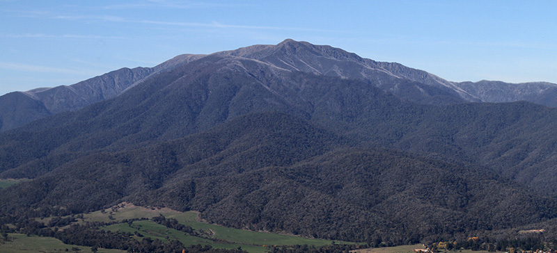
English: Mount Bogong, the highest mountain in Victoria, looking east from Sullivans Lookout on the Tawonga Gap Rd. Victoria, Australia.
თარიღი
წყარო პირადი ნამუშევარი
ავტორი


John O'Neill (jjron)


You can contact me about this image, its re-use, or to make a gratuity (donation) by leaving a message on my talkpage or by sending me an email.

This and/or similar images may be available from me in a higher quality or higher resolution format if required. Different terms or a fee may apply.


უფლება
(ფაილის მეორეული გამოყენება)
Public domain ეს ნამუშევარი მისი ავტორის John O'Neill (jjron) at ინგლისური ვიკიპედია მიერ გადაცემულია საზოგადოებრივ დომენში. ეს მოქმედებს მთელი მსოფლიოს მასშტაბით.
ზოგიერთ ქვეყანაში ეს შეიძლება იურიდიულად შეუძლებელი იყოს, ასეთ შემთხვევაში:
John O'Neill (jjron) უფლება მისცა ნებისმიერს, რათა გამოიყენონ ეს ნამუშევარი ნებისმიერი მიზნით, ყოველგვარი წინაპირობის გარეშე, თუ რაიმე პირობა კანონის მიერ არ არის მოთხოვნილი.


Plain English explanation for the use of this image


All users

I, the author, release this image into the Public Domain as Copyright Free for use worldwide.


You may:
  • copy, modify, and use this image in any way you choose.
However, I request that you follow the guidelines and moral obligations set out below.


You may be morally obliged, wherever possible, to:
  • acknowledge John O’Neill or jjron as the creator of this image.
  • acknowledge Wikipedia or Wikimedia Commons as the source of this image.
  • provide a hypertext link to this source image.
  • make a donation or payment if you reasonably expect to financially profit from use of this image.


You may encourage me to continue to contribute free high quality images by:
  • contacting me to let me know how you have found this image useful or reused it.
  • contacting me to express appreciation for donating my images to Wikipedia.
  • making a gratuity or donation to help me pay for equipment and expenses in order to continue creating and submitting free images to this project;
  • those using this image for personal, educational, non-profit, or other small scale purposes can contact me for details if you would like to make a donation.
  • commercial users may feel obliged to make a payment to me in line with usual business expenses that are otherwise avoided by use of this image.


You may NOT:
  • claim ownership, creation, copyright, or attempt to resell this image as your own work.
  • alter the licensing associated with this image. I require that freedom of usage of this image and any derivatives remains in place worldwide in perpetuity.
  • use this image in any way that suggests that I endorse or are in any way associated with you, your image usage, or your organisation without my prior consent.


You should NOT use this image in any way that:
  • promotes environmental degradation in any form.
  • is derogatory or harmful to any human individual, community, society, or culture.
  • diminishes or denigrates the sum of human knowledge.
Please contact me if you are unsure whether your usage is in breach of this guideline.


Alternatives
This and/or similar images may be available in a higher quality or higher resolution format if required.
Different licensing terms or a relicensing fee may apply for these alternative images.
Please contact me with enquiries by leaving a message on my talkpage or by sending me an email to arrange terms.
სხვა ვერსიები
კამერის მდებარეობა36° 43′ 05,94″ ს. გ., 147° 07′ 52,72″ ა. გ. Kartographer map based on OpenStreetMap.იხილეთ ეს და სხვა ახლომდებარე სურათები საიტ(ებ)ზე OpenStreetMapinfo

Captions

Add a one-line explanation of what this file represents

coordinates of the point of view ინგლისური

36°43'5.938"S, 147°7'52.716"E

source of file ინგლისური

original creation by uploader ინგლისური

captured with ინგლისური

ფაილის ისტორია

დააწკაპუნეთ თარიღზე/დროზე ფაილის დასათვალიერებლად, როგორც ის მაშინ გამოიყურებოდა.

თარიღი/დრომინიატიურაზომებიმომხმარებელიშენიშვნა
მიმდინარე14:38, 13 მაისი 2013მინიატურა 14:38, 13 მაისი 2013 ვერსიისთვის800×364 (144 კბ)Jjron{{Information |description={{en|Mount Bogong, the highest mountain in Victoria, looking east from Sullivans Lookout on the Tawonga Gap Rd. Victoria, Australia.}} |date=2013-05-09 |source={{own}} |author={{User:Jjron/credit-pd-autho...

ეს ფაილი არცერთ გვერდზე არ გამოიყენება.

ფაილის გლობალური გამოყენება

ეს ფაილი გამოიყენება შემდეგ ვიკებში:

მეტამონაცემები