
ფაილი:Livland 15jh.png
ზომა წინასწარი გადახედვისას: 666 × 599 პიქსელი. სხვა გაფართოება: 267 × 240 პიქსელი | 533 × 480 პიქსელი | 1 000 × 900 პიქსელი.
თავდაპირველი ფაილი ((1 000 × 900 პიქსელი, ფაილის ზომა: 2,23 მბ, MIME ტიპი: image/png))
| ეს ფაილი მდებარეობს Wikimedia Commons სერვერზე. იხილეთ მისი აღწერის გვერდი სრული ინფორმაციისთვის. |
 |
გადასვლა ფაილის გვერდზე |
რეზიუმე
| აღწერა |
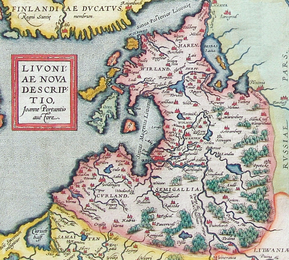
ლათინური:
Livoniae nova descriptio, Joanne Portantio auctore. Deutsch: Historische Karte von Livland, vermutlich im 15. Jahrhundert.
English: Historical map of Livonian Confederation, Antwerpen, 1573–1598. First published in Theatrum Orbis Terrarum (1570–1612) by Abraham Ortelius.
22 × 24 cm |
| თარიღი | 1573 - 1598 |
| წყარო |
Deutsch: Erbstück
Scan by Exxu |
| ავტორი | Joannes Portantius |
| სხვა ვერსიები |
 |
ლიცენზია
|
This work is in the public domain in its country of origin and other countries and areas where the copyright term is the author's life plus 100 years or fewer. | |
| This file has been identified as being free of known restrictions under copyright law, including all related and neighboring rights. | |
ფაილის ისტორია
დააწკაპუნეთ თარიღზე/დროზე ფაილის დასათვალიერებლად, როგორც ის მაშინ გამოიყურებოდა.
| თარიღი/დრო | მინიატიურა | ზომები | მომხმარებელი | შენიშვნა | |
|---|---|---|---|---|---|
| მიმდინარე | 00:01, 12 ნოემბერი 2006 | | 1 000×900 (2,23 მბ) | MapMaster | Beschreibung: Historische Karte von Livland, vermutlich 15. Jahrhundert Description: Historical map of Livonia, likely 15th century Quelle: Erbstück Urheber: unbekannt Datum vermutlich: 15. Jahrhundert Scan by Benutzer:Exxu This is a copy of [[w:de::Bil |
ბმულები
ამ ფაილზე ბმული მოცემულია შემდეგ გვერდებზე:
ფაილის გლობალური გამოყენება
ეს ფაილი გამოიყენება შემდეგ ვიკებში:
- გამოყენება ar.wikipedia.org-ში
- გამოყენება be-tarask.wikipedia.org-ში
- გამოყენება be.wikipedia.org-ში
- გამოყენება ca.wikipedia.org-ში
- გამოყენება da.wikipedia.org-ში
- გამოყენება de.wikipedia.org-ში
- გამოყენება en.wikipedia.org-ში
- გამოყენება eo.wikipedia.org-ში
- გამოყენება et.wikipedia.org-ში
- გამოყენება eu.wikipedia.org-ში
- გამოყენება fr.wikipedia.org-ში
- გამოყენება hu.wikipedia.org-ში
- გამოყენება it.wikipedia.org-ში
- გამოყენება la.wikipedia.org-ში
- გამოყენება lv.wikipedia.org-ში
- გამოყენება nl.wikipedia.org-ში
- გამოყენება pt.wikipedia.org-ში
- გამოყენება ru.wikipedia.org-ში
- გამოყენება sh.wikipedia.org-ში
- გამოყენება sk.wikipedia.org-ში
- გამოყენება tr.wikipedia.org-ში
- გამოყენება tt.wikipedia.org-ში
- გამოყენება uk.wikipedia.org-ში
- გამოყენება www.wikidata.org-ში