ფაილი:F. Müllhaupt's Militarische & Verkehrs-Karte der Deutsch-Französischen Grenze...jpg

გვერდი სხვა ენებზე არ არის ხელმისაწვდომი.
მასალა ვიკიპედიიდან — თავისუფალი ენციკლოპედია

თავდაპირველი ფაილი((8 150 × 6 978 პიქსელი, ფაილის ზომა: 75,1 მბ, MIME ტიპი: image/jpeg))

ეს ფაილი მდებარეობს Wikimedia Commons სერვერზე.
იხილეთ მისი აღწერის გვერდი სრული ინფორმაციისთვის.
გადასვლა ფაილის გვერდზე
Warning The original file is very high-resolution. It might not load properly or could cause your browser to freeze when opened at full size.
აღწერა Titre :
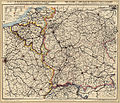
Deutsch: F. Müllhaupt's Militärische & Verkehr's-Karte der Deutsch-Französischen Grenzen (...)
Français : Carte militaire et commerciale des frontières franco-allemandes ainsi que des Etats limitrophes de la Belgique, de la Hollande et de la Suisse / par F. Müllhaupt
English: Map military and commercial Franco-German border and the neighboring states of Belgium, Holland and Switzerland

Auteur : Müllhaupt, Fritz (1846-1917)

Éditeur : Müllhaupt

Date d'édition : 1885

Sujet : Frontières

Sujet : Allemagne, Empire d' -- Sud-Ouest -- Frontières

Sujet : Belgique -- Est -- Frontières

Sujet : Suisse -- Frontières

Sujet : France -- Nord-Est -- Frontières

Sujet : Pays-Bas -- Frontières

Type : document cartographique,carte,image fixe

Langue : Multilingue

Format : 1 flle en coul. ; 680 x 580

Format : image/jpeg

Droits : domaine public

Identifiant : ark:/12148/btv1b53023072n

Source : Bibliothèque nationale de France, département Cartes et plans, GE C-859

Relation : http://catalogue.bnf.fr/ark:/12148/cb405950294

Couverture : Belgique

Couverture : Suisse

Couverture : France

Couverture : Pays-Bas

Description : Échelle(s) : 1:1 250 000

Provenance : bnf.fr
თარიღი
წყარო F. Müllhaupt's Militarische & Verkehrs-Karte der Deutsch-Französischen Grenze
ავტორი Müllhaupt, Fritz (1846-1917)
უფლება
(ფაილის მეორეული გამოყენება)
Previous public domain rationale, no longer applicable
Public domain
This image from the Bibliothèque nationale de France (BnF) is a reproduction by scanning of a bidimensional work that is now in the public domain ({{PD-scan}}). For this reason, it is in the public domain.
This image can also be seen on Gallica: Image btv1b53023072n.

العربية  Deutsch  English  español  français  galego  italiano  日本語  македонски  Nederlands  português  русский  sicilianu  slovenščina  українська  +/−

Open this image as an overlay in Google Earth (Google Maps, Bing) (Help|Source)

Featured სურათი

ვიკისაწყობი

This is a featured picture on Wikimedia Commons (რჩეული სურათები) and is considered one of the finest images.

If you have an image of similar quality that can be published under a suitable copyright license, be sure to upload it, tag it, and nominate it.

Annotations
InfoField
This image is annotated: View the annotations at Commons

Captions

Add a one-line explanation of what this file represents

Commons quality assessment ინგლისური

Wikimedia Commons featured picture ინგლისური

ფაილის ისტორია

დააწკაპუნეთ თარიღზე/დროზე ფაილის დასათვალიერებლად, როგორც ის მაშინ გამოიყურებოდა.

თარიღი/დრომინიატიურაზომებიმომხმარებელიშენიშვნა
მიმდინარე13:02, 4 აპრილი 2013მინიატურა 13:02, 4 აპრილი 2013 ვერსიისთვის8 150×6 978 (75,1 მბ)ComputerHotline{{LargeImage}} {{Information |Description= Titre : F. Müllhaupt's Militarische & Verkehrs-Karte der Deutsch-Französischen Grenze.... Carte militaire et commerciale des frontières franco-allemandes ainsi que des Etats limitrophes de la Belgique, de l...

ამ ფაილზე ბმული მოცემულია შემდეგ გვერდებზე:

ფაილის გლობალური გამოყენება

ეს ფაილი გამოიყენება შემდეგ ვიკებში:

მეტამონაცემები