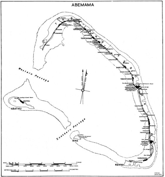
ფაილი:Abemama Map.jpg

ზომა წინასწარი გადახედვისას: 562 × 600 პიქსელი. სხვა გაფართოება: 225 × 240 პიქსელი | 450 × 480 პიქსელი | 720 × 768 პიქსელი | 959 × 1 024 პიქსელი | 1 919 × 2 048 პიქსელი | 5 310 × 5 667 პიქსელი.
თავდაპირველი ფაილი ((5 310 × 5 667 პიქსელი, ფაილის ზომა: 1,32 მბ, MIME ტიპი: image/jpeg))
ფაილის ისტორია
დააწკაპუნეთ თარიღზე/დროზე ფაილის დასათვალიერებლად, როგორც ის მაშინ გამოიყურებოდა.
| თარიღი/დრო | მინიატიურა | ზომები | მომხმარებელი | შენიშვნა | |
|---|---|---|---|---|---|
| მიმდინარე | 20:07, 28 ნოემბერი 2005 |  | 5 310×5 667 (1,32 მბ) | Marshman~commonswiki | Slightly larger version of same |
| 18:13, 28 ნოემბერი 2005 |  | 3 540×3 778 (708 კბ) | Marshman~commonswiki | Government map with inscription "H Green 20/4/1970" I obtained the "original" as a blueline printing in the 1970s. I believe these maps were produced for government use by the Gilbert Islands Colony. I have scanned and slightly altered the original (1/50 |
ბმულები
ამ ფაილზე ბმული მოცემულია შემდეგ გვერდებზე:
ფაილის გლობალური გამოყენება
ეს ფაილი გამოიყენება შემდეგ ვიკებში:
- გამოყენება ce.wikipedia.org-ში
- გამოყენება de.wikipedia.org-ში
- გამოყენება el.wikipedia.org-ში
- გამოყენება en.wikipedia.org-ში
- გამოყენება es.wikipedia.org-ში
- გამოყენება fi.wikipedia.org-ში
- გამოყენება gl.wikipedia.org-ში
- გამოყენება he.wikipedia.org-ში
- გამოყენება hu.wikipedia.org-ში
- გამოყენება mk.wikipedia.org-ში
- გამოყენება pt.wikipedia.org-ში
- გამოყენება ru.wikipedia.org-ში


